Содержание проекта
I. Анализ контекста — местонахождение проектируемой территории и её история — ландшафтно-визуальный анализ участка — отзывы местных жителей и туристов о территории — выводы об участке проектирования
II. Проектное предложение — концепция планировочной организации территории — генеральный план — предложение по организации ландшафта и спусков — архитектурные объекты: деревянные мостки, павильоны, реставрация Каменного моста, новые бани на старом месте
Часть I. Анализ контекста
Местонахождение проектируемой территории
Калуга — город в 160 км к юго-западу от Москвы, расположенный на берегах Оки и её притоков — Яченки, Калужки, Киёвки. Березуйский овраг — территория в центре Калуги, представляющая собой густо заросшую деревьями лощину.

Расположение Калуги относительно Москвы; расположение проектируемой территории в городе.
Этот рельеф образовался в результате таяния ледника, и в последствие стал важным стратегическим объектом для города: по оврагу проходила граница Калужского кремля и Завершья, а позднее он стал разделять город на две части.
Сейчас территория оврага никак не используется, а вместо существовавших когда-то бань и усадьбы в овраге остались хаотичные самострои, на место ручья Березуя пришла ливневая канализация.
Ландшафтно-визуальный анализ территории

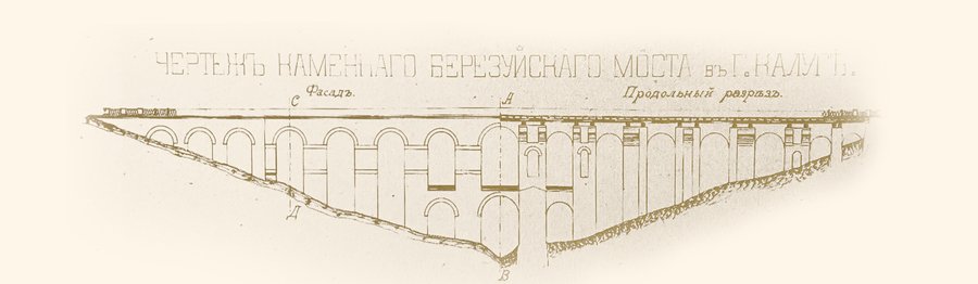
Каменный мост
Проект моста разработан архитектором Петром Романовичем Никитиным в стиле русского классицизма (1777– 1780 гг). Длина конструкции — около 160 метров, высота около 20 метров. Мост опирается на 15 крупных каменных арок, центральные арки сделаны в 2 этажа.


Архивные документы из книги: Калужский Березуй: опыт документального описания / составитель и редактор В. Н. Фридгельм. — Изд. 2-е, доп. — Калуга: Фридгельм, 2021.
Что говорят туристы и местные?
Орфография и пунктуация авторов сохранены.
Полные отзывы можно прочитать здесь.Выводы об участке проектирования
Достоинства: — уникальная для городской среды территория; — сохранившийся памятник культурного наследия — Каменный мост; — расположение в центре города; — присутствие водотоков — ручья Березуя, Оки; — история места.
Недостатки: — отсутствие связи с городом; отсутствие у территории выраженной функции; — хаотичные самострои; — большое количество сорняковых, сухих деревьев, мешающих осмотру оврага; — загрязненный и частично убранный в трубу ручей Березуй.
Пути решения: — очистка оврага от сухих и сорняковых деревьев; — восстановление ручья; — укрепление берегов; — создание парковой зоны; — организация связей с городом.
Часть II. Проектное предложение
Концепция проектного предложения — организация в овраге линейного разноуровневого парка, который связывает город в двух направлениях: поперек — правый и левый склоны, и вдоль — верхнюю и нижнюю часть оврага. Парк формируется несколькими смысловыми слоями, каждый из которых имеет свою функцию.
Первый — это три пути-артерии. Они пронизывают весь овраг и задают три параллельных вектора, к которым ведут организованные спуски от прилегающих улиц. В местах, где спуски непосредственно подходят к трем главным осям, предусмотрены деревянные мостки, по которым можно перейти с одной оси на другую. Заключительный слой составляют павильоны, расположенные на обоих склонах оврага. Часть из них — это смотровые площадки, часть — закрытые павильоны, в которых можно присесть и отдохнуть.
генеральный план
1 — теннисные корты 2 — прогулочная аллея 3 — торговая площадь 4 — руины бань Давингофа (консервация) 5 — бани 6 — малая торговая площадь 7 — большая торговая площадь
S проектируемой территории = 10, 2 га S территории объекта культурного наследия федерального значения «Каменный мост» = 6, 2 0; га Общая протяженность: металлических пандусов = 709,62 м деревянных настилов = 807,1 м лестниц = 714,5 м
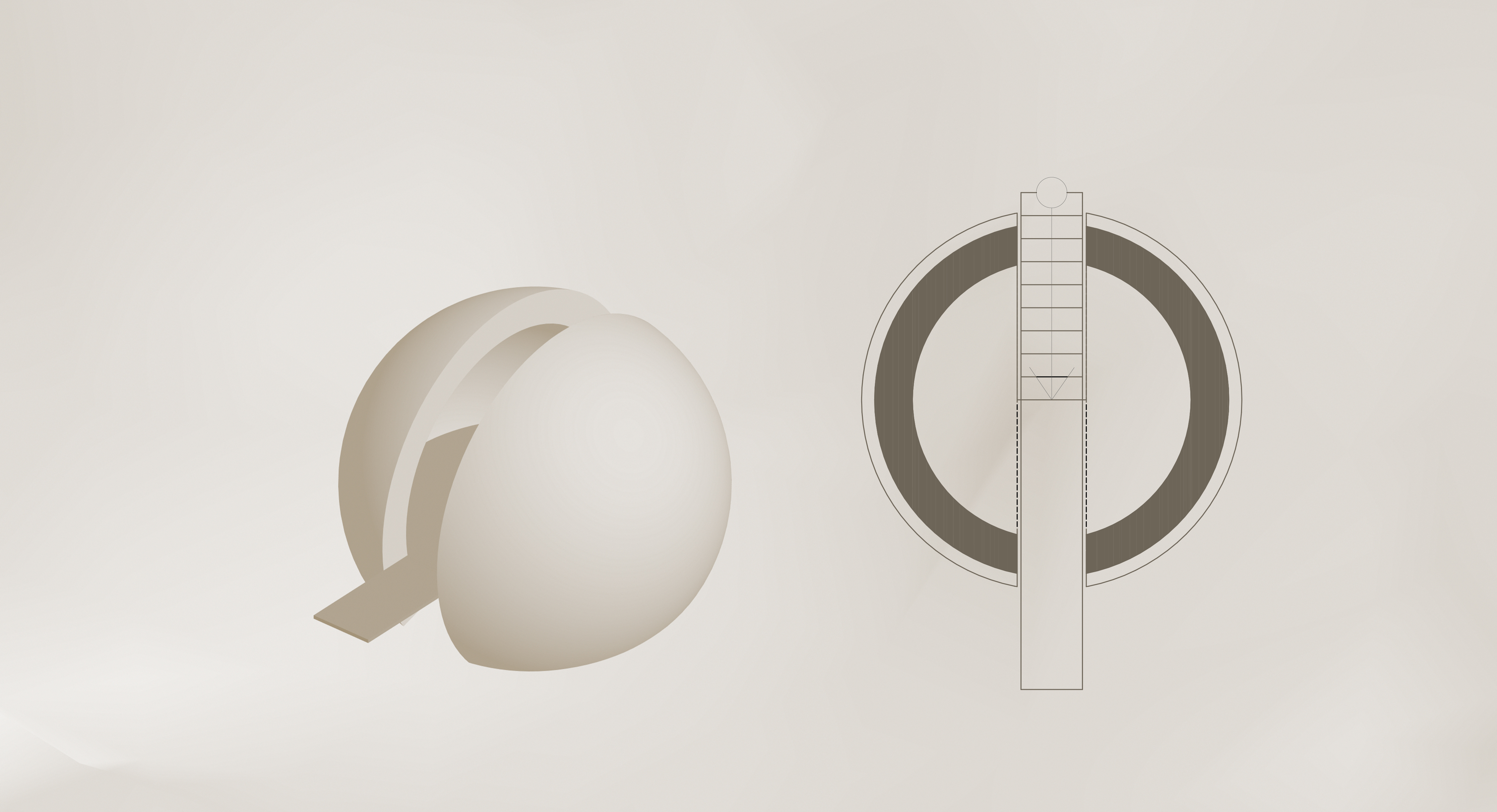
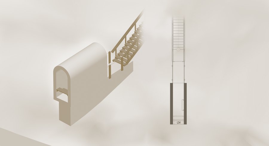
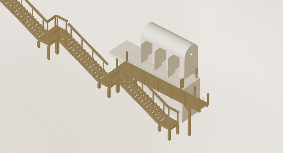
Деревянные мостки
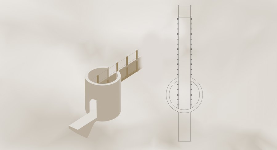
Раньше — в XIX и XX веках — через ручей в овраге в нескольких местах были перекинуты деревянные мостики, а вели к ним крутые лестницы. С опорой на эти сооружения была создана типология деревянных конструкций, которые отвечают за спуск в овраг и обеспечивают поперечные связи между его склонами.
тип 1 — лестница, тип 2 — лестница+смотровая площадка;
тип 3 — лестница+двухуровневая смотровая площадка;
тип 4 — поперечный мосток.
Схема организации спуска. Высотные отметки даны относительно минимальной высотной отметки ручья Березуя.
Павильоны
Слева: полицейская будка у спуска к источнику; в центре: часовня над источником «Здоровец»; справа: часовня у Покровского храма.
«…в начале прошлого столетия со стороны современной улицы Космонавта Комарова была устроена каменная лестница с полицейской будкой к источнику», — пишет Сергей Сычёв в статье «Тайны Березуя».
Территория Березуйского оврага имеет статус объекта культурного наследия федерального значения, и, согласно российскому законодательству, на данной территории запрещено капитальное новое строительство. Поэтому в проекте предлагается восстановить утраченные сооружения — две часовни и полицейскую будку — и размножить их по территории оврага.

Ротонда, Обсерватория, Библиотека, Будка и Спутник, Шалаш
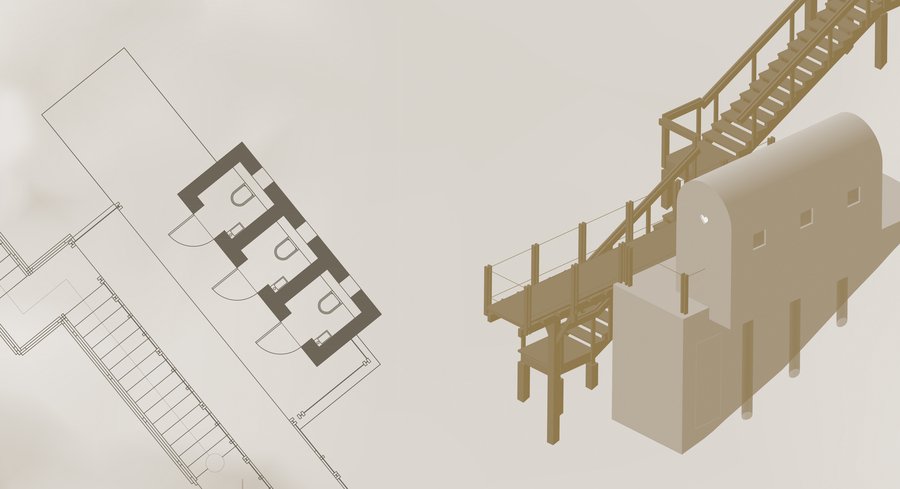
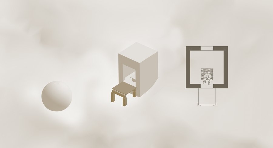
Анти-арка (общественный туалет)
В 1870-1880-х источник Здоровец был огорожен деревянным срубом; внутри которого находилась икона Николая Чудотворца. В 1892 году была воздвигнута каменная одноглавая часовня с шатровой крышей.
Часовня не сохранилась, остались только фрагменты её фундамента. Окончательно она была разрушена в 70-х годах прошлого века. На её месте установлена мемориальная доска.
Надкладезная часовня над источником «Здоровец»
Реставрация Каменного моста
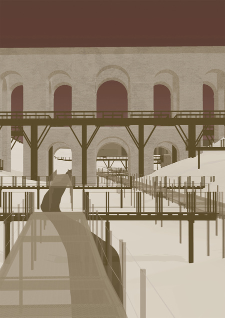
Каменный мост был построен в 1785 году, с тех пор много раз реставрировался. После последних работ по ремонту моста его покрыли белой штукатуркой. Теперь оригинальный красный кирпич можно увидеть только точечно на надломах и разрушенных участках. В качестве проектного решения предлагается реконструкция моста, демонтаж штукатурки и восстановление изначального облика; строительство временных разноуровневых деревянных конструкций по периметру для удобства осмотра
Вид с конструкций по периметру моста
Новые бани на старом месте
В начале и середине XIX века в Березуйском овраге было несколько бань: две деревянные мещанина Николая Соколова, деревянные бани мещанина Михаила Мешкова и каменные бани мещанина Якова Кольцова, крытые тесом. В 1882 году Давингоф купил имение Сапожниковых с банями. В народе эти бани стали называться Давингофскими. Эти бани использовались в СССР вплоть до 1987 года, пока не были закрыты.
Сейчас на месте бань — руины. Их предлагается законсервировать, и поблизости построить две новые деревянные бани, которые будут сдаваться в аренду.


